

Today’s post is by John Romeo Alpha, a fellow bike enthusiast and a blogger. I absolutely love JRA’s blog One Speed:Go!
John Romeo Alpha currently commutes by bicycle every day, and has been a Phoenix resident for more than 20 years. He is passionate about all types of bicycling, and is always looking for new and interesting ways to connect canal, path, road and mountain on two wheels. He chronicles his thoughts and explorations on his blog, One Speed: Go!
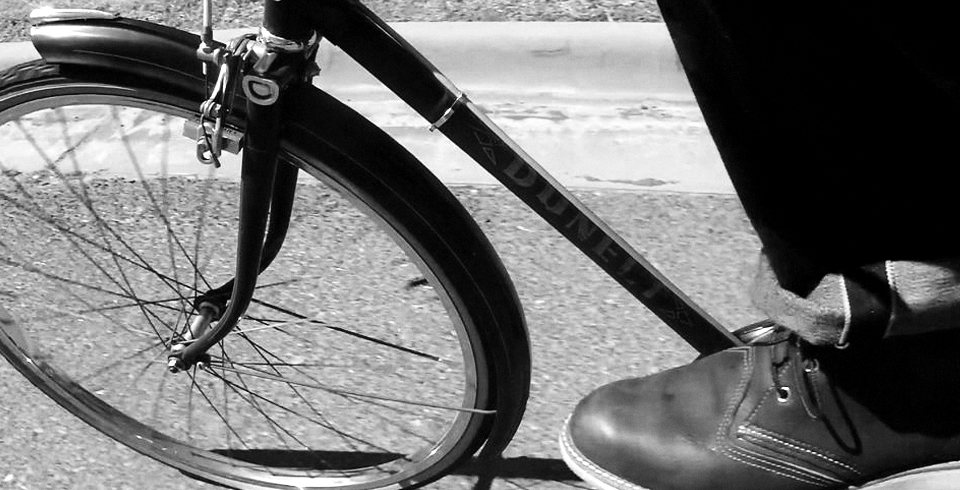
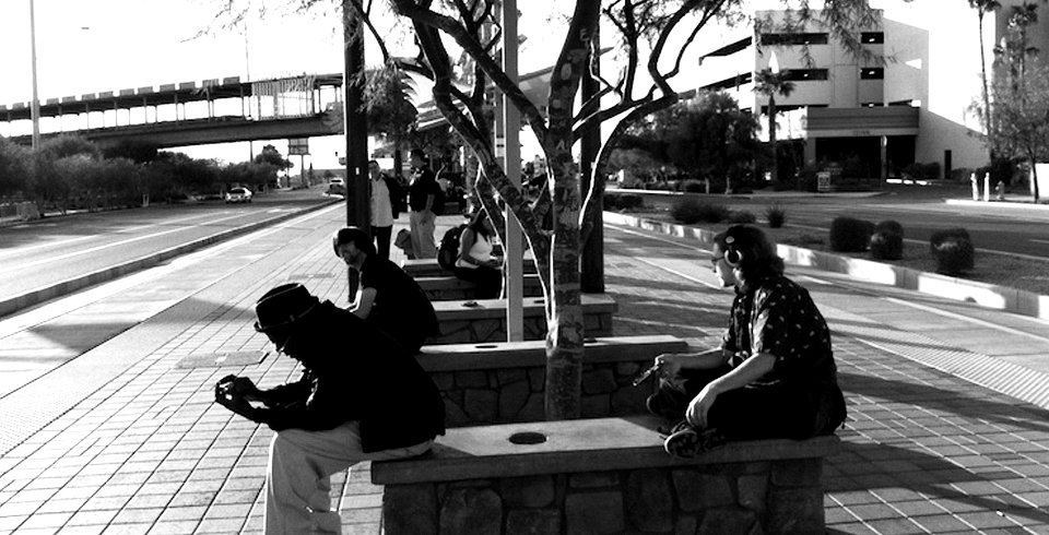
On a sunny day between Christmas and New Years, JRA is meeting up with Tommy, a once-fit friend who is visiting the Valley for the holidays. Tommy remembered that JRA likes to ride bicycles, and suggested over dinner the previous evening that they go for a ride in order to get a low-level view of Phoenix, since the weather was excellent. JRA told him where to rent a road bike. They agreed to meet the next morning at the plaza across from the Nuss Building in Scottsdale. JRA commutes by bicycle to work every day, and has been working on a year-in-review post for his blog, so he’s well equipped with statistics and information for Tommy on this ride. Tommy rides up, and finds JRA standing next to the bike rack next to the bridge.
Hey JRA, ready for a ride? What is this place?
Tommy! This is the Soleri Bridge and Plaza, just dedicated a few weeks ago. It’s a kind of sundial/monument to possibility. It’s art on a human scale. See the red line down the middle? At solar noon a sunbeam lights it up.
Cool! Where are we riding? I’ll punch it up on my smart phone.
Downtown, to the new Cityscape project, about 12 miles one way. But your smart phone will be of limited use for navigation.
Really? I’ll pull up the bicycling directions feature on Google…
Go ahead, but it won’t help much. You’ll see.
Okay. I want to try it out anyway, since I want to start cycling again. I need to drop some weight.
It accumulates, doesn’t it? A few years ago, I noticed that I was on a steady, two to three pounds per year, fat savings plan. Twenty years since high school graduation, and BAM! I turned it around with diet, and keep it off with cycling every day.
Looks like I’m on that savings plan myself. I would like to close down the account.
Heh. Let’s go, what’s your phone say?
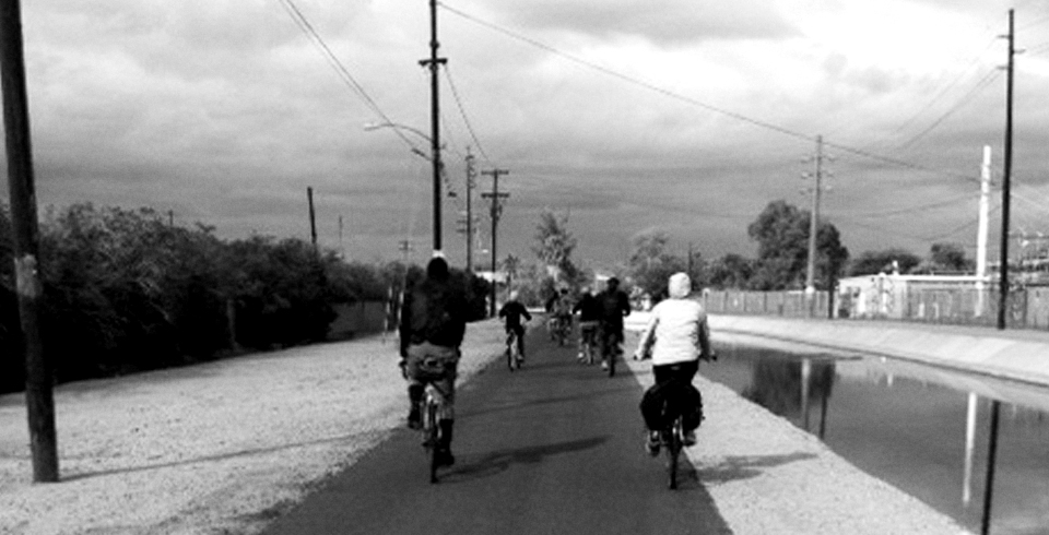
West along the Arizona Canal.
That’ll work until we get to the mud. (they ride along the Scottsdale Waterfront, then under Goldwater Blvd through the underpass). Here, we need to cut through this parking lot.

Underpass at Goldwater Blvd.
Why? That’s not on the map.
The canal just ahead gets pretty sloppy after a rain. You definitely don’t want to take those skinny tires through it. I know, I’ve tried. We’ll cut through to the Indian School bike lane, and take it over to 56th.

The Arizona Canal after a rain
(They ride Indian School Road, and JRA signals to merge over to the left turn lane. They wait while the light is red).
JRA, why don’t we stay on Indian School? It’s a great bike lane.
It dies just up ahead, and dumps you into a busy traffic lane. I’d ride it, but I want to encourage you to keep riding, and that’s kind of a trial by fire. We’ll cut down to Osborn, and take that over to 48th. Osborn is a quieter street.
Why does does the bike lane just die like that? It kind of catches you off-guard, riding from Scottsdale into Phoenix.
I don’t know what’s behind that engineering. I asked a former Scottsdale official once: “Why does the Indian School bike lane just die out as soon as it crosses into Phoenix?” Her answer was, “I don’t know, that’s Phoenix.” Which I think was very honest. But it also showed me something that is missing: a systematic and consistent bicycle planning strategy across the region.
What do you consider “the region?”
For planning purposes, I think the Phoenix Metropolitan Statistical Area should be the container for all our best ideas about cycling. It’s about sixteen and a half thousand square miles, about the same size as the Netherlands, and has over four million people.
Is there a lot of cycling in the region?
Well, that depends. I think the Census figures are around 1% of commuters cycle to work like I do. Very low, in other words. On the other hand, I checked the transit statistics on the Valley Metro site for a blog post I’m researching, and found that 2009-10 bicycle boardings were 817,571 out of 44.7 million total boardings, or about 1 in 54.6.
817,000 bicycle boardings last year? That seems like a lot of bicycling going on, did you see a trend?
I couldn’t pick out a trend, no, the total ridership numbers bounce up and down, and light rail was just added, so it may be too early. But as I thought about it, this may actual represent close to the peak percentage of bicycle boardings on the metro.
The peak? Why?
I am not sure if the the physical design of the rail cars and buses would support much more. Buses with racks are limited to two bikes per bus, and the light rail cars also have a limit, although I have seen people stand with their bikes. If the buses and light rail is full, though, it doesn’t seem like much more than 2% (1 in 50) of riders could board with bikes anyway. Just a guesstimate, though.
This path is cool, what is it?
This is the 48th Street, a long, narrow park on top of the Old Crosscut Canal.
Nice curvy trail.
Wait till we get to the end though. Here we are, go up the grass over there.
Why?
This trail dead-ends on McDowell, with no way across right there. We might as well just head directly to the crosswalk to continue down 48th Street.

The end of the trail on McDowell and 48th St.
Does this fall under your heading of a need for a systematic and consistent regional bicycle planning strategy?
Well, yeah, look at the south end of this trail! Where does it go? It would be the equivalent of McDowell Road just dead-ending right here, with no signage or explanation, just boom, end of the line. This inconsistent, changeable routing gives cyclists, particularly novices, a feeling of uncertainty about where to go, about how to get around. Because ultimately, it’s about getting around. If you don’t feel confident about that, the chances you’ll keep riding seem pretty slim. The way it is in Phoenix today, though, you have to be ready for anything. To a degree much higher than with cars, you never know what will be around the next corner when you are cycling. I’m used to it, and have learned enough over several years to be comfortable with it. But I feel that has a lot to do with our low cycling numbers.
Aren’t there city cycling programs, safety brochures, and stuff like that?
(they cross McDowell with the crosswalk light, and head down the 48th Street bike lane).
Sure, I’ve read plenty of those. City of Phoenix, Scottsdale, Mesa, Tempe, Chandler, I’ve seen many good-intentioned and even financed plans from them. There’s also the Maricopa Association of Governments, or MAG, which has put out pedestrian and cycling plans covering much of this region. Online, I found a Tempe Bikeways brochure from 1974, which really crystallized the problem for me, though.
How so?
It’s a model of good ideas and fun design. It is well thought-out, and presents a thorough plan for achieving its goals, by supporting each goal with several objectives, and laying out policies that support each objective. The plan was adopted by the City of Tempe, and money allocated. Bike lanes, signage, education for drivers and cyclists, marketing, awareness, vision, future plans, it was all there 36 years ago. I’m sure there are some lessons learned that would lead to some updates today, but still, reading it, I was struck with one overwhelming feeling of futility and deja vu. Hell, we don’t need more studies to reinvent this, why not just reprint this brochure from 1974? And why hasn’t all this beautiful integrated and active bicycling culture taken off since then? Something must be missing. OK, right turn here on Washington. I love this part, by the way. It’s a bicycling superhighway all the way downtown.
What do you think was missing from that 1974 plan, JRA?
When I read that publication, the one concept that I found missing was the most significant change in this region over those 36 years: growth. The word doesn’t even appear in the brochure. Not once. They didn’t plan for it. If you compare the Valley today with 36 years ago, it’s a completely transformed environment, now dominated by sprawl, and ruled by the automobile. Maybe I shouldn’t expect those planners from the early seventies to have encompassed all this. OK, but now we can. We can look around and say to ourselves, well, this 1974 visionary planning approach did not account for a big factor. What we need to succeed now is a systematic and consistent bicycle planning strategy across the region which recognizes the current primacy of the automobile, and the realities of rapid population growth and urban sprawl. We need to plan for bicycles to fit into all that.
Hey, what’s this little jog to the left the bike lane makes?
It’s not obvious what’s going on, is it? Washington splits here, so we’re going to cross the street to get over to that semi-protected side lane on the other side of the light rail. It’s a weird little turn, for sure, and if traffic is busy, you may have to wait for two lights to get through this intersection. On my shorter-tempered days, I sit here and think: this just pisses me off, to have to sit here in the heat and wait for two lights. I can’t imagine a similar setup for cars: wait for two light changes to cross an intersection. Not only is it annoying in this spot, but once you figure it out, that skill won’t help you anywhere else that I know of. It’s a peculiar, one-of-a-kind traffic skill. That’s why I say “systematic, consistent, and regional.” The way it works here should be the same as everywhere else in the Valley, with signage and conventions that apply no matter where you ride. Otherwise, what is probably intended to encourage and support cycling actually has the opposite effect by fostering uncertainty and lack of confidence in beginners. Sign, sign, give me a sign.

Bike lane on Washington St.
Putting up clear signs across such a large metropolitan area sounds like a tall order, JRA.
Not at all. There’s already a highly successful example we passed just a few minutes ago.
There is?
Yes, the people or department who have put up the “Clean up after your dog” signs with attached bags have done a bang-up job across the Valley region. Everywhere there’s one of the dog signs next to a path or junction, if we could get the same crew to erect a sign with directions to nearby attractions and connecting paths and routes, distances to water and shelter, and maybe with sponsorship, nearby coffee and/or bike shops, that would go a long way toward creating the confidence of knowing where you are, and where you can go next.

A dog sign
What kind of attractions would you put on the signs?

Signage for cyclists in Tempe
Art, museums, shopping districts, all that. Riding down along the New Crosscut canal yesterday, I was struck that I was cycling past one of the great botanical gardens of the world, yet had no indication, not even a modest and attractive garden entrance. Desert people have long valued what I call the Oasis Pattern. Living in an immense concrete desert here, a cyclist appreciates even more the elements of the oasis: natural shade, water, a quiet place to rest. Yet, gems like the Desert Botanical Gardens, the LoPiano Mesquite Bosque in Tempe, the little waterfall at Rio Salado restoration area, these all have nearby cycle paths, with currently no signs and little or no connection with the surrounding area. On trails out in the desert, you see cairns to indicate places where trails continue, little piles of rocks to help out your route-finding. We have great routes in the Valley. We have great oases and other attractions. We just need the equivalent of cairns to guide people down the routes, and to show them how to stay on them when they twist or turn, like this lane just did.

The LoPiano Mesquite Bosque
Once you’re over here, though, this semi-protected lane seems great.
It is.
(They cruise at a fast pace from 24th Street to 7th Street)
Until the lane dies out here.
Now what?
Ready for anything. We practice vehicular cycling until we get to Cityscape.
Where do we go? What do we do?
Now you see what I mean about the effects of these unexpected changes on the novice cyclist. Just follow me. We’ll stay on the left over here, because we’re going to turn left ahead, and I prefer riding a straight line rather than weaving all over the place. It’s not too busy today, anyway. On a normal day, we’d probably cross over to the right side at the next signal, again possibly waiting for two lights to get through the intersection, then cross back when we got to Cityscape.
It’s disconcerting when the bike lane paint stripe just ends like that on a busy street.
Sure. Don’t get me wrong, paint is no panacea. Cyclists need to learn a whole mixed bag of skills to get around safely, which I think is job #1 before calling for more paint or infrastructure. But, if a city is going to put down paint, like bike lanes and sharrows (shared lane markings), it should be done within a context of a whole, consistent regional cycling strategy, or else it becomes as much a deterrent as an aid, as I mentioned before.
(they arrive at Cityscape at First and Washington, which is partially under construction).
Ah, our destination.
OK, so what is “Cityscape?”
There used to be open space here called Patriot’s Square Park, which has been replaced with this combination shopping mall and office space. It’s someone’s idea of a monument to commerce, I guess. Which is fine, if that’s what your city needs.

Cityscape where Patriot’s Square Park used to be.
What was the motivation for doing that?
The main reason I have heard is that Patriot’s Square was full of homeless people.
You know, whenever I hear statements like that, I learn more about the city and its people, than about parks and the homeless.
Yeah, I know. I just visited Union Square in New York on a farmers’ market day, and had fantastic noodles for lunch at Republic. People who think you need chain stores and office space to create a vibrant urban plaza should stop by there first, maybe grab a bench next to a homeless person, and strike up a conversation, share some artisan bread and heirloom tomatoes.
So, where do we park our bikes to have a look at Cityscape, JRA?
There’s this 3-pronged rack in front of LGO, but let’s just carry our bikes up the stairs so we can just pass through. Unless you want to skate on a small rink, I don’t think we’ll actually stop here today.

Cityscape bike rack
(They carry their bikes up the stairs, and stop in front of an information kiosk).
It says that there’s a New Year’s Eve party here. Check it out JRA, Metal Elvis is playing! Let’s get tickets.
Yes, Metal Elvis, the perfect way to ring in the New Year at Cityscape.
You want to go grab a coffee at Starbucks? (Tommy sits down at an empty table).
Nah, I know a local place in my own neighborhood. Then I want to ride over and show you some hopeful examples: the south end of the Scottsdale green belt near Tempe Town Lake with shade, water, signs, and benches all in once spot, the New Crosscut Canal path, or maybe Thunderbird Paseo Park and the multi-use path along Skunk Creek. Come on. Get up. Go ride.
Photo Credit: All photos by the author.


Excellent article! I agree a Regional plan for biking (and transportation) is exactly what we need. Sadly for a City that has lovely biking weather at least 8 months of the year we/the City(ies) do a pretty poor job with bike infrastructure.
I hope the next Mayor of Phoenix makes biking a priority, with a goal to take PHX from probably a bottom 20 biking city to a top 20 (though Im not sure exactly how you quantify that sort of thing numerically).