

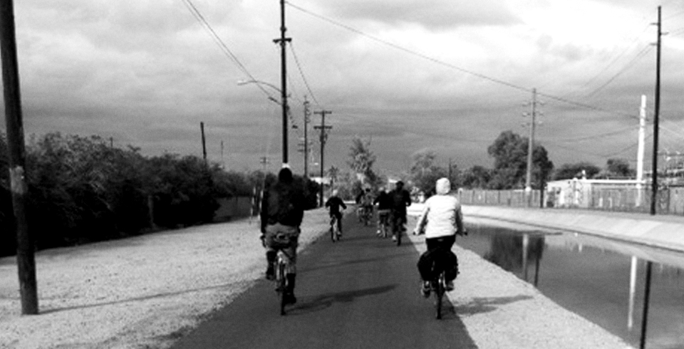

The Bicycle Boulevard is planned to start at the northeast part of the Gateway Community College campus. One entry point is the Grand Canal at 40th Street and Van Buren. The nearest Light Rail stops are 38th St. and Washington and 44th Street and Washington. Once you get on the Grand Canal, proceed northwest. A foot bridge will be built to get from the canal to Roosevelt Street. The path then heads west on Roosevelt all the way to 19th St, then south on 19th Street to either McKinley or Fillmore. There are three choices of where the Bike Boulevard can go in the Garfield neighborhood and through Downtown, one is straight west on McKinley, another is Pierce (at 14th Street) and the third option is Fillmore. Currently, the McKinley route gained most traction at the last Bike Boulevard meeting. Any of these three routes would take the biker west to 11th Avenue and cross the pedestrian bridge over I-10 and then west to 15th Avenue. Going north on 15th Ave will take you to Encanto Park, Phoenix College, Christown Mall and the Arizona Canal just north of Dunlap Ave. A foot bridge is planned for the Arizona Canal as well.
Essentially, the bike boulevard would be connecting Gateway Community College to Downtown, to northwest Phoenix. The Light Rail stop at Gateway connects Tempe and part of Mesa to the bike boulevard as well, extending the reach even further. Plus, let’s not forget that the bike boulevard will also serve those who ride to Sky Harbor Airport, like the employees.
The bicycle boulevard would consist of new bicycle lanes, take advantage of existing bicycle lanes, and where bicycle lanes can’t go in, there will be 24” bike dot markings every 250’ or less. Bike dots will go on local (neighborhood) streets where there is no room for bicycle lanes. Depending on which of the three Downtown routes is chosen, there will be 1 to 3 special pedestrian or bicyclist activated signals known as HAWKS (High-intensity Activated crosswalks) added at busy road crossings.
Since this project is relatively inexpensive to implement, funding for the bicycle boulevard will likely come from the normal capital improvement program or CIP. The bicycle boulevard is projected to be in place by early 2011.
If you have questions or comments or want to give your two cents on where the boulevard should go, leave me a comment and I’ll forward it on to Joe Perez, the City of Phoenix Bicycle Coordinator.
Image credit: Handout by the City of Phoenix Streets and Transportation Department


Hi Taz. I attended what I think was the first meeting regarding this and there was some discussion of the desirability of having the boulevard connect up to Lower Grand. I missed the last meeting and I don’t see from your notes whether or not this was discussed further.
I am wondering if it possible for the connection to jog down to Fillmore at some point and then come across to 11th Avenue and then go north from there?
Should I send this comment on to Joe?
Beatrice, I’ll send your comment on to Joe! If you want to contact him directly for further discussion here’s his email: joseph.perez@phoenix.gov
This is great, and I look forward to riding it on a regular basis. A tie-in with the canals is a very exciting aspect of this project. As part of the final result, I feel it would be useful and informative to show the Bicycle Boulevard with more context and connections to the nearby and connecting, existing bike routes. Washington with its great bike lane should be shown on the final map, along with nearby bicycle features like the little-known yet awesome Rio Salado path that starts at 24th Street and the River, along with any other North/South connections, which may be challenging. Also, I was wondering if something like a neighborhood meeting at Crockett Elementary would be in order, to talk with the neighborhood where the Boulevard will connect with the canal, to discuss with them the plan, and the advantages it offers. A map might also clear up some navigational challenges on a bike, too: for example, what would be the best way to bike from the Bicycle Boulevard to The Duce? Google Maps bicycle routes suggests south on 1st Street. A map that would orient the boulevard within the surrounding area and existing bike facilities would help show how it fits into the bigger picture of riding a bike around this great city.
all great suggestions John! I’ll forward your comments to Joe and let you know what they say….
It is such a valuable resource which you are providing and you’re giving it away cost-free. I enjoy discovering web-sites that recognize the importance of delivering a valuable resource for no cost. I honestly loved reading your post 🙂 Many thanks
thanks Lilla
[…] and Wilcoxon described many interesting projects they have in the works. One is a bicycle boulevard, which is basically a glorified bike lane on low-speed roads. It’s relatively cheap, so the […]
[…] looking at improving bicycle infrastructure, some promising steps being the development of the Bicycle Boulevard, the proposed road diet on Central between Camelback and Bethany Home and the new bicycle parking […]